
Atlases Charts and Maps
Showing all 3 results
-

Then And Now Bible Maps Insert
$16.99Add to cartRose Bible Map Insert–An ultra-thin Bible atlas that fits in the back of your Bible.
This incredible full color Bible atlas has clear plastic overlays of modern-day cities and countries. Now you can have “Then and Now” Bible maps inside your Bible. Includes 44 pages; 8 plastic overlays; all maps in full color; larger print than other Bible map inserts; every major city in the Bible; a Bible time line; index; separate maps for each of Paul’s Journeys. -
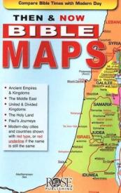
Then And Now Bible Maps Pamphlet
$4.99Add to cartWhere are Bible Lands today? This handy quick reference fold-out shows you! It contains more than a dozen Bible maps that include the modern-day boundaries in red. Fantastic for comparing places in the news with places in the Bible.
Includes the following maps:
*The Middle East during Old Testament Times
*The Assyrian Empire, Babylonian Kingdoms and Persian Empire
*The Holy Land during the time of the Old Testament
*United Kingdom, Divided Kingdom compared with modern-day Israel and surrounding countries
*The Holy Land during the time of JesusAll of Paul’s Journeys (Roman Empire at AD 60)
Fits in the back of most Bibles. Size: 8.5″ x 5.5″ Unfolds 38 inches.
-
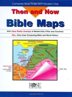
Then And Now Bible Maps
$19.99Add to cartTrying to connect the “Middle East” of the six o’clock news with the Holy Land of the Bible? Here’s a resource that fills in the blanks! Transparent maps of modern-day Mediterranean and Middle Eastern countries lie flat over Bible maps showing the lands and cities where the patriarchs, Jesus, and the apostle Paul traveled. Tremendously helpful!